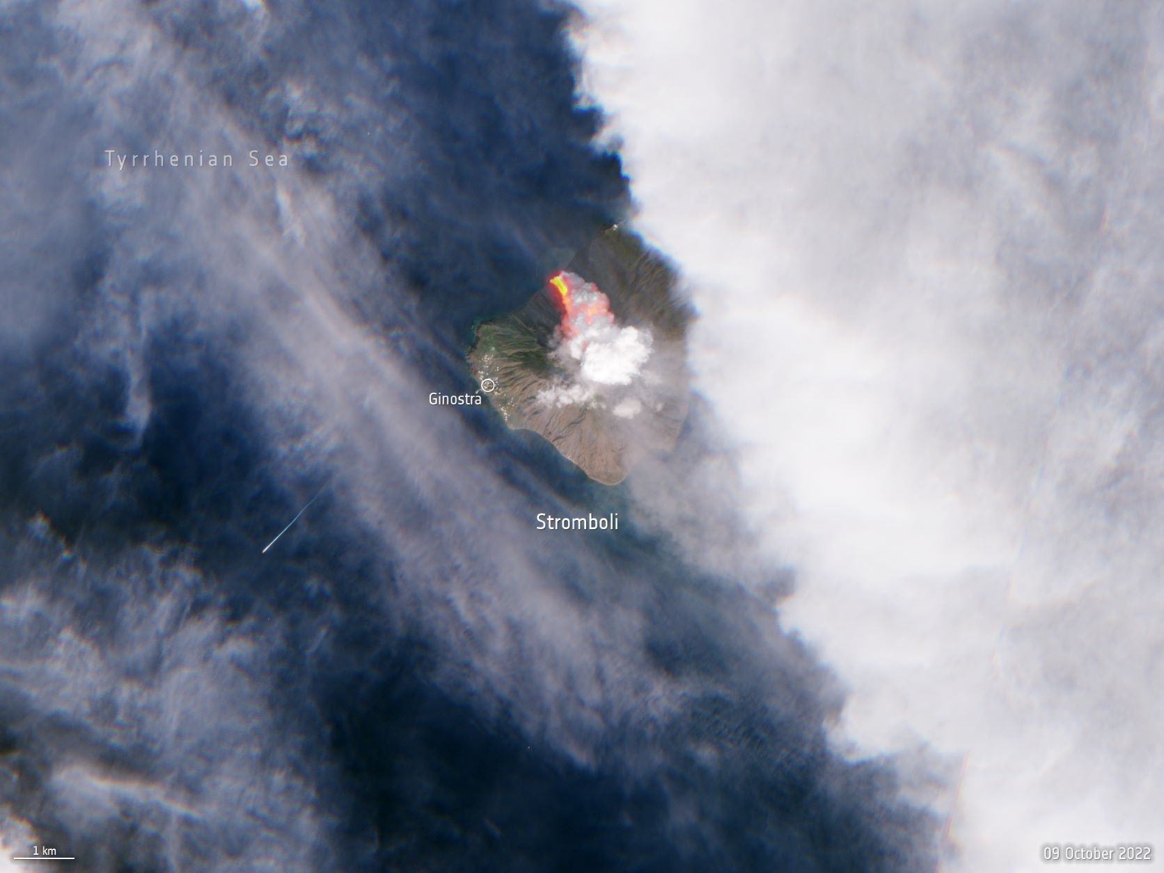
A striking image of the eruption of Italy’s Stromboli volcano was captured in space by Europe’s Sentinel-2 satellite, part of an Earth observation mission from the Copernicus Programme, shortly after it erupted.
This fissuring of magma to the Earth’s surface and the forming of lava at the Stromboli Volcano took place on October 9th, and the Sentinel-2 satellite captured an image that was processed in true colors.
The captured image shows the volcano erupting, sending a pyroclastic flow of lava pouring into the Tyrrhenian Sea with huge plumes of smoke and ash rising above the volcano.

Italy’s Stromboli Eruption and Enhanced Volcano Imbalance
The Stromboli volcano and its namesake, the Stromboli volcanic island, are located in southern Italy just off the northern tip of the island on the coast of Sicily in the Tyrrhenian Sea.
According to a statement from the European Space Agency (ESA), its eruption caused the partial collapse of the volcano’s crater terrace, thus prompting Italian Civil Protection authorities to raise an orange alert due to the persisting “situation of enhanced volcano imbalance.”
About three hundred people permanently live on the island of Stromboli. Most of the population on the island live in the village of Ginostra, which is located to the southwest of the volcanic cone.
During the past ninety years, the Stromboli Volcano has been erupting frequently making it one of the most active volcanoes in the world.
On the same day as the Stromboli eruption, The Sentinel-2 satellite captured images of “hot areas” on the Mount Etna Volcano in Sicily. Mount Etna is located only about sixty miles (one hundred kilometers) away from Stromboli.
Although satellites have detected hot plumes on Mount Etna, which is as active as Stromboli, no lava has spewed out of the active volcano.
Both Stromboli and Mount Etna erupted on the same day back in May 2021, a phenomenon suggesting that a link may exist between the two volcanos.
Scientists, however, believe that the two volcanos are part of unconnected systems which each possess their own patterns of eruption and magma generation.

Sentinel-2 Assesses Recent Nord Stream Gas Pipeline Leak
The Sentinel-2 space mission, which captured the eruption of Italy’s Stromboli Volcano, is part of the Copernicus Program run by the European Union and ESA. It consists of Sentinel-2A and Sentinel-2B Earth observation satellites.
Its Sentinel-5P satellite was involved in assessing the scale of the recent Nord Stream gas pipeline leak observed by multiple satellites. Hundreds of tons of methane bubbled up from the damaged Nord Stream 1 and 2 pipelines last week.
The ESA said in a statement that the emissions from the leak were a drop in the ocean when compared to the annual emissions of the global oil and gas industry, which amount to eighty million metric tons.
Other satellites, however, also returned a bit of good news, confirming that the amount of climate-warming methane that escaped from the pipelines into the atmosphere was relatively small compared to overall annual emissions.


